Information from deposit records and evidence collected as part of the Ipswich Urban Archaeology Database project has helped us to understand more about the depth of the surface geology and the deposit sequences.
By using dedicated software, the modelling of specific urban archaeological deposits was attempted, to create a borough-wide database of deposit information, based on archaeological excavation and borehole data. It was possible to uniformly record two sources of information that enabled inter-site comparison: Depth of “natural” (undisturbed surface or “drift” geology) and depth to water table.
More detailed archaeological deposit data has only been possible on a small quantity of sites. These can be expressed as heights in metres above Ordnance Datum (OD) or as heights relative to existing surface. Within these types, there are two dataset variations, the much smaller sample, taken from sites where all data was available in OD, and a much larger coverage where depths are derived from ground surface taken from LIDAR data.
Results
2D surface maps of the historic core and other areas of the borough were created using this data.
These interpolated maps can show depth of made ground, natural subsoil and water table depth. This information has informed on the growth of the town and areas where preserved waterlogged archaeological material may remain. When interpolated depth of "natural" data is compared with interpolated water table data, we can suggest the locations of waterlogged deposits.
Colour graded point maps can also show site specific information on projected depths in a quickly accessible format to be useful in future town development and planning
The maps are indicative and should be viewed with caution as there is variability in the data, as in parts of the town there were fewer data points.
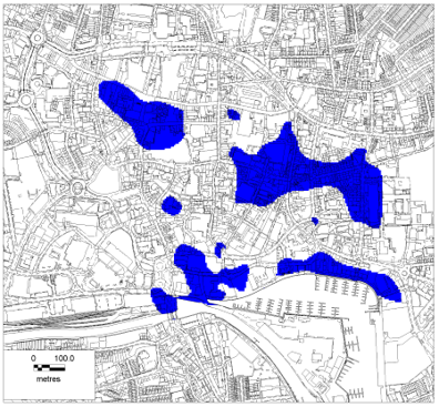
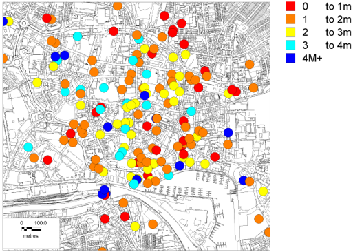
Image: Interpolated map showing that the water table shown in blue is higher than the natural surface geology (left) and Colour coded depths of archaeological deposits and made ground (right)