Geophysical survey techniques are used to both discover new archaeological sites as well as to help define and interpret known remains. They build up a picture of the past landscape, detecting archaeological features below ground. The results from a geophysical survey complement other survey methods, such as aerial photography and fieldwalking.
We recommend that an appropriate geophysical survey is undertaken on a site before planning an excavation.
See below for information on the different techniques and guidance on how to start planning a geophysical survey.
Different Techniques
Geophysical survey is a broad term covering several different methods all used to map contrasts between the physical properties of buried archaeological remains and the surrounding soil.
When choosing which geophysical technique to use several factors need to be considered, including the type of site, the expected nature and burial depth of the archaeology and the area to be covered given the time available. Local site conditions such as vegetation, geology, soils and terrain also influence the decision.
The different techniques are also often best employed in combination to maximise the information obtained.
Earth Resistance ‘resistivity’
Resistivity is a useful survey technique for building remains, such as foundation or walls, particularly masonry buildings. It works by measuring the local soil moisture content over a site with an electric current via electrodes pressed into the ground. Ditches filled with moisture will have low resistance; more solid features which as masonry will have high resistance. The best time to conduct a resistivity survey is spring or autumn when the ground conditions are less likely to be waterlogged or too dry.
Ground Penetrating Radar (GPR)
Ground Penetrating Radar (GPR) is useful to record the depth of buried archaeology and can also operate over hard surfaces such as tarmac and concrete. The GPR sends a short pulse of radio frequency into the ground and records the time and amplitude of any reflections from buried remains.
Magnetometer Survey
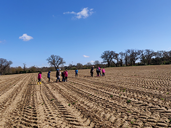
Magnetometer survey is the most widely used technique as it can cover a lot of ground quickly. Usually, a fluxgate gradiometer is used, which records subtle changes in the local magnetic field. Buried features have different magnetic properties to the surrounding soil. Archaeological remains such as kilns, hearths and furnaces can be detected by the alteration of iron minerals burning into strongly magnetic forms.
Ditches and pits can be seen when they have silted up with more magnetic topsoil from adjacent settlements. Buried building remains may also be detected but only if the magnetic stone contrasts with the surrounding soil.
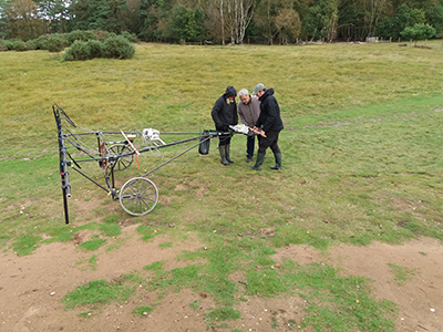
There are different types of magnetometer machines, including hand-held and carts. When conducting a magnetometry survey, be aware of overhead cables or metal fences which could impact the results.
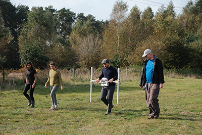
It is also important not to wear anything metal, the smallest amount will affect the magnetometer readings. This can be a challenge, so here is our advice on what to wear for a magnetometry survey:
- Remove all jewellery, watches and piercings. Avoid wearing glasses, unless 100% titanium. No hair grips unless all plastic. Hats must be free of metal ventilation eyelets and any other metal fittings such as decorative buckles in hatbands.
- For clothing, check your pockets are empty, watch out for metal studs on denim shirt pockets or insignia initials on shirts. Avoid anything with zips, chrome or copper-coloured pocket rivets, metal buttons, belts, buckles, metal eyelets on cord waist ties. Best to wear: basic layers, such as a thermal vest, shirt/sweatshirt/rugby shirt, t-shirt, jumper. Tracksuit bottoms, shorts, leggings, trousers with non-metal buttons
- For coats, watch out for any metal fittings, as most coats have stud pocket fasteners and zips; even plastic zips can still have some metal components. Best to wear: Lots of layers and jumpers. A traditional duffel coat is a common solution, with horn or plastic toggle closures.
- For shoes, avoid boots/walking boots with steel toecaps, reinforced arches/soles, metal lace eyelets or metal buckles on the sides. Best to wear: Trainers or Wellies – if they bend, they do not have steel arches/soles/toecaps – be careful of metal buckles on the side. If you’re not sure if your boots have metal, bring a second option with you to change into if needed.
Planning a geophysical survey
Geophysical survey is a specialist skill, requiring specific equipment and preparation. Equipment hire can also be expensive, so it is best to team up with a local amateur group, university or archaeological unit who may already own or have access to and experience with the equipment.
Before you start, it is important to write a project design and do your research and planning , so you are clear about what you are doing, how you are doing it and why. Remember you must obtain permission from the landowner and tenant. Geophysics on a scheduled monument would also need a licence from Historic England/Secretary of State. The Archaeological Service can help advise on your project.
To help you to decide which geophysical survey technique to use, you will need to consider the size of the site, type of archaeology you are hoping to find, past land use and the underlying geology.
Magnetometry is often the best place to start to get a broad picture of the site and then you can decide whether to use a secondary technique to target particular areas or possible features, for example Earth Resistance surveys will be better at identifying stone structures.
Further guidance
Geophysical Data in Archaeology: Guide to Good Practice, Archaeological Data Service (2009)[View on archaeologydataservice.ac.uk]
Archaeological Geophysics: a Short Guide (18), British Archaeological Jobs Resource (2008)[View on bajr.org(PDF)]
Guidelines for the Use of Geophysics in Archaeology, Historic England (2016)[View on historicengland.org (PDF)]
Step by Step Guide to Conducting a Geophysical Resistivity Survey and a Magnetometry Survey, Jigsaw Cambridgeshire and how to process the data [View on jigsawcambs.org(PDF)]