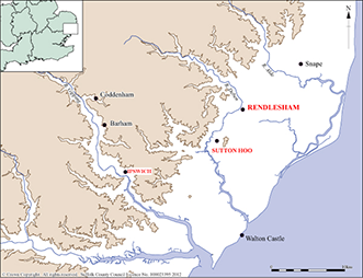
During the 2000s the landowners of the site at Rendlesham were alarmed by frequent evidence of people digging holes in their fields at night, damaging crops and presumably stealing metal artefacts. The Suffolk County Council Archaeological Service (SCCAS) was consulted and initially suggested a systematic metal detecting survey to discourage the thieves and discover what was being stolen from the site.
Since 2008, SCCAS have therefore been co-ordinating a pilot project involving a combination of systematic archaeological surveys, including metal detecting, geophysics, air photography and desk-based research, as well as small scale excavation at Rendlesham. The aim was to study the character, extent and condition of the archaeology. The results suggest a place which was significant from the 5th to mid-8th century AD and was certainly a large, wealthy and connected place in the late 6th and 7th centuries.
A large number of local partners, academics and professionals, landowners and volunteers have contributed to various aspects of the work so far, which would not have been possible without their support. The academic advisor to the project is Professor Christopher Scull (consultant archaeologist and Honorary Visiting Professor at University College London and Cardiff University). Special thanks goes to Sir Michael and Lady Bunbury for their unwavering support, and to the volunteer metal detectorists Alan, Rob, Roy and Terry, for their hours of dedication.
Further work is being undertaken in 2020-2023 as part of the community archaeology project Rendlesham Revealed. For updates or to get involved in the project, sign up to our e-newsletter.
The Rendlesham site is on private farmland and has no public access.
Systematic Metal Detecting Survey
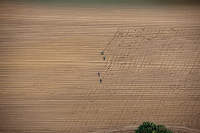
The principle survey method was surface collection by systematic and comprehensive metal detecting, undertaken by a team of 4 local volunteer detectorists who each spent an average of 170 days a year on the survey. In the first year, this showed that the fields which were being looted contained high status 5th to 8th century objects. The survey was extended over 160 hectares (400 acres), which recovered objects from the plough soil - which had either been dropped on the ground in the past or had been ploughed up from the below ground archaeological features. The exact location of each find was recorded using a hand-held GPS device, which allowed the density and distribution of the artefacts to be mapped on geographical information system software. Over 5,000 archaeological objects were found by the detectorists; these were recorded by SCCAS's Finds Recording Team who identified, catalogued, photographed and drew each object.
Image: Aerial photograph of volunteers conducting a systematic metal detecting survey © Historic England
Geophysical Survey
Geophysical survey, specifically magnetometry survey, helped to set these surface finds into their context. This revealed many pit-type features and ditched enclosures coinciding with the main concentrations of the early medieval metal detected finds. The results also confirmed historic landscape features, such as a small medieval green as shown on an 18th century estate map.
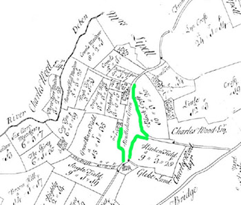
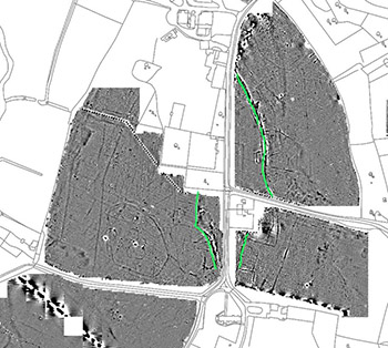
Image: 18th century map (left) and geophysical survey (right) showing medieval green
Aerial Photography
The available aerial photographs were examined for cropmarks which were mapped as part of a larger project called the National Mapping Programme, funded by Historic England
When combining the cropmark results with the geophysical survey results, they revealed an exciting discovery - a possible large timber building, which is perhaps likely to be an early medieval (5th-8th century) hall.
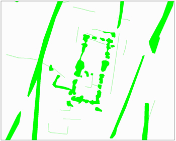
Image: Outline of possible hall transcribed from cropmarks and geophysical survey results
Small-scale Excavation
In October 2013 and April 2014, seven evaluation trenches were opened, each measuring 5m by 10m in two fields, to investigate the results of the survey. These were carefully positioned to provide as much archaeological information as possible. The excavations relied on a core group of volunteers helping to dig, to detect and to sieve the excavated soil. Every context fill was sieved, as was a sample of the plough soil from each trench.
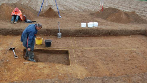
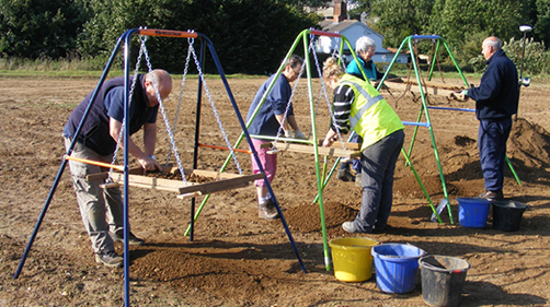
Image: Volunteers excavating a 5th-6th century sunken featured building (left) and sieving excavated soil (right)
In the first field, evidence of sunken-featured buildings indicated a settlement dating 5th to 6th century. These buildings are comparable to those at West Stow Anglo-Saxon Village. There was also at least one cemetery as several damaged cremation urns were found. The surface finds in this field suggest that there may be inhumation burials (skeletons) as well as cremations here. Coinage from this field show that there was activity there in the 7th and 8th centuries, however no evidence has been found for any buildings of this date, which perhaps means this location was used for temporary meetings and trading.
In the second field, a major 7th century boundary ditch was found, along with an area of dark soil with many animal bones, which must be the rubbish heaps from the 7th and 8th century settlement. Another ditch turned out to be part of a Late Iron Age (1st century AD) D-shaped enclosure. Near the medieval green ditches of 11th to 14th century date were found.
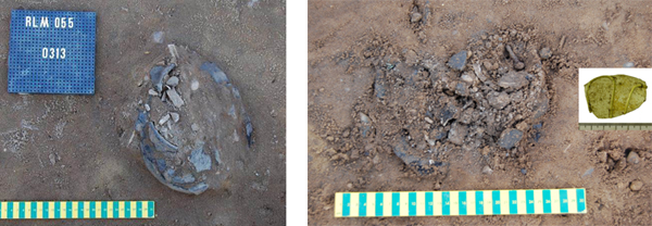
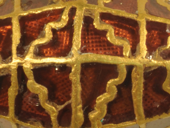
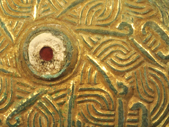
Image: Cremations damaged by ploughing, excavated at Rendlesham
This work was supported by: