You can explore the known archaeological sites and find spots in Suffolk using the interactive map.
Here is some guidance to help you to navigate the map and use the toolbars
Right hand tool and information bar
Right hand tool bar (top of the screen) - You can find the area you are interested in by using: the zoom tools, previous and next map extent arrows, and using your mouse to pan by holding down the left mouse button and dragging the map.
Right hand information bar (bottom of the screen) - The position of the map (by Easting and Northing) and the zoom level.
Left hand tool bar
Search
Location – For the location search, the parish or postcode can be used.
Grid Ref - Grid references should be provided as two letters, followed by three to five numbers for both the easting and northing.
Map Layers
The 'Layers' tab on the left allows you to choose which types of information you wish to display. Each layer will always show on the map in the order listed in the tab, so (for instance) if you wish to view the Registered Parks/Gardens in an area more clearly, it may help to turn off the overlapping layers, such as the 'Monuments' and 'Events'.
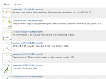
Monuments - Describes and indexes an interpretation of the archaeological or architectural features represented on a site.
Events - Defines a diverse range of activities as events, all involving the collection of information or judgements about the monuments at a particular location e.g. geophysical survey, excavation etc.
Scheduled Monuments - Are historic buildings or sites that are included in the Schedule of Monuments kept by the Secretary of State for Digital, Culture, Media and Sport. The regime is set out in the Ancient Monuments and Archaeological Areas Act 1979. For the definitive information on a Scheduled Monument please use the National Heritage List for England.
Listed Buildings – Are buildings of special architectural and historic interest and are protected by law, information please visit Historic England and for the definitive information on a listed building please use the National Heritage List for England.
Registered Parks and Gardens – Are parks and gardens of special historic interest. for the definitive information on a Registered Park or Garden please use the National Heritage List for England.
Base Layers
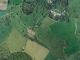
There are three base layers to choose from, OpenStreetMap, Ordnance Survey map and Bing Aerial Photograph, and their opacity can be adjusted on the slider at the bottom of the screen.
Info
Use the pointer to display a shortcut to the selected detailed record.
Record List
These displays shortcuts to the detailed record of all features visible on the screen (Tip: Open the records in a new Tab or Window, to retain the Record List)
Tools
Print map, download map and share map.